Analysis of laser scanning point clouds in VIENNA
TOPIC: LiDAR
DATE: 13th/14th April 2023
HOST: TU Wien – Technical University of Vienna
CREDITS: certificate for 1 ECTS + attractive prizes
PARTICIPATION: group of 3 – 4 participants
RECOMMENDED ABILITIES: interest in geodata and 3d point clouds, quantitative data analysis and GIS, or talent in data visualization and graphic design, or focus on entrepreneurship, software development, marketing, or curiosity and fantasy

The challenge has been focusing on Laser Scanning Point Clouds as state of the art 3D data for describing our environment in detail, over large natural and built-up areas, through time. For the event, different point clouds have been available for exploring their content, creating and describing new applications or implementing innovative analyses of point clouds.
Point clouds acquired by airborne, drone-based, terrestrial or mobile laser scanning are used in a variety of problems and applications supporting sustainable resource management, communication, and decision making. Still, their knowledge in society is limited, and we are looking for new ideas and solutions for technical problems as well as for interaction within society.
One technical field of application is, e.g., the monitoring of ground deformations due to mining activities, whereas participatory communal city planning could be virtualized by creating web-based 3D immersive discussion platforms.
CHALLENGES
The event is specifically open for creative and technical approaches, and groups are invited to concentrate on either creative design, technological development and implementation, or even a combination of both.
The essence of the event has been the focus on creating an environment that fosters learning and expression in both the technical and the creative domain. Participants were encouraged to explore and generate new ideas related to the exploitation of point clouds and the field of deformation monitoring. The hackathon served as a platform for participants to collaborate, innovate, and push the boundaries of these areas, ultimately contributing to advancements and breakthroughs in these specialized fields.
The lecturers, mentors, and jury were involved on site in the event. As a lecturer, Norbert Pfeifer kicked off the activities and introduced the goal and basic guide.
Six existing data sets were provided explicitly for this event. These datasets capture the variety of LiDAR data and allow a range of applications to be explored
The provided point cloud included close and far range datasets, with point densities ranging from 10-1000 points/m2 covering natural, anthropologically formed, and built-up areas and multi-temporal datasets, including data with additional attributes (color, classification, etc).
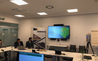
A JupyterLab environment served as programming platform. The common web-based infrastructure provides:
-
- IPython notebooks
- Notebooks in other programming languages (like C++)
- A desktop including a graphical environment with QGIS pre-installed
The hackathon was organized in three phases
-
- Introduction and group building (plenary session)
- Challenges, the main phase (group work)
- Presentation of results, summary and award ceremony (plenary session)
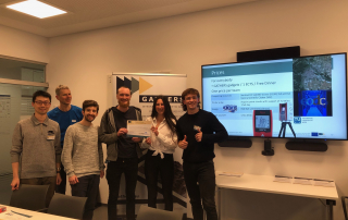
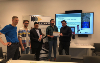
TEAMS
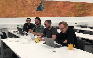
Three groups were formed. Each group chose a name on its own.
The Italian Dream has had two members studying in Italy.
Manalo is a PhD student with the background of Civil Engineering, focusing on 3D laser scanning survey. Like his partner, Mamić is also a PhD student, with the experience of remote sensing, earth observation and geoinformatics.
The A-Team has variety in terms of country, background, and study degree. Pierzchała is a master student in the field of Geoinformatics at UPWr, while Los has an MBA degree in a different domain. Both are from Poland. Mayregger, the third member, is a bachelor student at TU Wien from Austria, studying Geodesy and Geoinformation.
The PointClouders is a unique group as all members are from the Department of Geodesy and Geoinformation at TU Wien. Due to their background, a certain level of experience in point cloud processing has been posed in this group. The main reason for their attendance, forming as a group, is to explore more applications in the world of point cloud and to gain interest from this journey.
REWARD OF THE INVOLVEMENT
Who has been judging the ideas and solution?
A jury, including experts from academy, industry and stakeholders have been evaluating all solutions of the hackathon.
As part of the university funding project, sponsorships were secured to offer attractive prices to the participants.
Prices given away within the event have been organized by TU Wien directly.
Besides some goodie Bags of GATHERS project the organizing team reached out to potential sponsors, including technology companies, start-ups, and local businesses, seeking their support in providing prices.
These prices have been showing recognition to participants’ achievements and encourage their active involvement throughout the hackathon.
- Computing resources at the supercomputer Vienna Scientific Cluster with access to the full archive of Sentinel-1 and Sentinel-2 Earth observation data of the Copernicus program
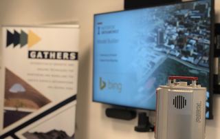
- The allowance to an entire day of laser scanning with a terrestrial laser scanner with support from TU Wien personnel and the possibility to use the data for own research or other purposes
- Measurement instruments from Leica (a Lidar distance measurement tool)
- as well as Energy drinks, of course ;)